

HM Coastguard
- Allan & Helen

- Aug 4, 2025
- 8 min read
During our visits to Cardigan and Mumbles Lifeboat Stations in Wales, we experienced our first launches on service or “shouts”. Whilst at Mumbles, crew members Adam and Josh were explaining the discussion on the radios between HM Coastguard and various vessels before the pagers sounded. It was not the first time we had heard the Coastguard over the airwaves but it got us thinking that we need to understand more about their operation and link it all together.
After some enquiries, we were absolutely thrilled to be offered a visit and tour of the Coastguard centre in Dover. The full title is the Maritime Rescue Coordination Centre (MRCC) of which there are 10 locations around the coast of the UK.
We arrived at the security barrier at the site, near St Margaret's at Cliffe just outside of Dover, and made our way to the main entrance where we were warmly welcomed by Tony. He is the Vessel Traffic Services (VTS) Manager and is also one of the Launch Authorities and mechanic at Walmer Lifeboat Station. He explained that he was retiring later in the week from his 26 years service in the VTS.
Our first stop on the tour of the MRCC was the Board Room. If you are going to have a building high on the clifftop over looking the English Channel then why not make it the focal point of a Board Room, what a spectacular view.
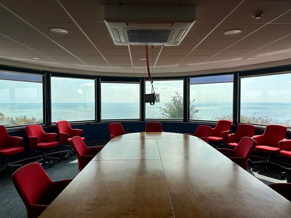
Tony explained that the facility was built on the site of Langdon Battery, which was a coastal gun battery first constructed in the early 20th century, and used during both world wars for the defence of Dover Harbour. The original concrete plinth of one of the batteries was clearly visible as the foundation of the boardroom with another forming the base of the operations room. A spiral staircase, just outside of the board room, led down to the magazines where the cartridge and shells were stored for the guns. There is also a tunnel which leads towards the cliff edge to a blocked wall, which led to an observation post beyond it.
Tony explained what we were looking at out of the vast windows. It was a clear sunny day and the French Coastline was clearly visible to the point where we could see the buildings in Calais. Below us was the busy Port of Dover with a constant flow of cross channel ferries and various other vessels. To the left we could see over the cliff tops to the disused South Foreland Lighthouse. To the right lay Dover Castle and beyond to Samphire Hoe.
HM Coastguard provide a 24-hour maritime and coastal search and rescue emergency coordination and response service for the UK. The Joint Rescue Coordination Centre (JRCC) based in Hampshire is the heart of the national coastguard rescue coordination system, connecting the 10 MRCCs around the UK from Falmouth to Shetland - covering over 11,000 miles of coastline. They also have a fleet of helicopters operating from 10 strategically located bases. In addition, there are also over 300 coastguard rescue teams based in communities around the coast made up of around 3,500 volunteers.
Vessel Traffic Services or VTS is part of the Governments Maritime and Coastguard Agency, the Channel VTS helps vessels navigate safely and aids preventing collisions in the Dover Strait. The service provides a 24 hour radio and radar safety service for all shipping in the Strait, one of the busiest shipping lanes in the World. Channel VTS is jointly operated by the UK and France from the MRCC and CROSS Gris Nez in France.
In another part of the building reside a UK Border Force team. Border Force is a law enforcement command within the UK Home Office. They secure the UK border by carrying out immigration and customs controls for people and goods entering the UK. The team based in Dover are mainly concerned with securing the border in the English Channel but teams can be found around the country at any port of entry such as Airports and Sea Ports.
Tony continued the tour, stopping by the spiral staircase leading down to the magazines which are now used a storage and archive. He showed us an impressive display cabinet of awards and memorabilia which will shortly include an RNLI Gold Medal for Gallantry that Tony has in his possession. We then headed into the vast operations room where the Coastguard team have an equally spectacular view of the Channel.


Here we were introduced to the team on shift; Ryan, Ryan, Kelly, Kim and Richard. One of the Ryans offered to explain the operation to us and what he could see on each of his four monitors. From his desk he could respond to 999 calls, deploy and coordinate rescue assets including helicopter, lifeboat and ground Coastguard teams and monitor any category of alert anywhere in the UK. Aside from the 999 calls, locator beacons can also be monitored from here. We had previously learned about these devices on our visits to some of the Lifeboat Stations. Personal Locator Beacons (PLBs) are typically small handheld personal safety devices that can be activated if someone gets into difficulty. They are often carried by fishermen in small vessels, Kayakers and small pleasure boat owners and are usually carried in lifebelts and flotation devices. Emergency Position Indicating Radio Beacons ( EPIRBs ) are for vessels and can be activated in times of distress. They provide a radio transmitted signal enabling rescue services to locate the vessel. The final type of locator beacon are Emergency Locator Transmitters (ELTs) carried by aircraft. It was Helen who enquired about aircraft ditching in the sea and being located and I thought we were progressing with her fear of flying – perhaps not quite there yet!
Ryan very kindly demonstrated a typical 999 call for Coastguard by calling in a “test”. The alert came up on all of the screens and was answered by the other Ryan. The response was immediate. Coastguard is often forgotten as an emergency service especially when living inland. As Ryan demonstrated, he had the ability to alert all emergency services if required for a response. “Taskings” are colour coded based on their severity and response required. For example a “Mayday” call from a vessel will be coloured Red on their monitors and a “pan pan”, orange. As we were chatting, the other team members were dealing with calls and responding to vessels which we could see unfolding on Ryan’s monitors.
Later we heard Dover Lifeboat call in to inform the team that they were departing on exercise. They provided details of time of departure, duration of the exercise and roughly where they would be as well as the number of crew on board. We then watched them depart their mooring and head out just beyond the harbour walls.
It was an absolutely fascinating insight into their work which was very complex and demanded a high level of concentration and skill. We thanked the whole team for their time and explanations before Tony took us to the final stop on our tour.
The final piece of the jigsaw at the MRCC is the nerve centre of VTS or Vessel Traffic Services. Tony sat us down in front of two large monitors which displayed a graphical representation of all of the shipping in the English Channel and beyond. I have an app on my phone called Marine Traffic which is very useful for identifying ships and finding out where Lifeboats are when we are out visiting stations. What Tony was showing us was a much more detailed equivalent. He had the luxury of being able to see vessels using Radar and AIS. Automatic Identification System (AIS), which is used in Marine Traffic Apps, makes use of transceivers on ships. AIS information supplements marine radar, which continues to be the primary method of collision avoidance for water transport.
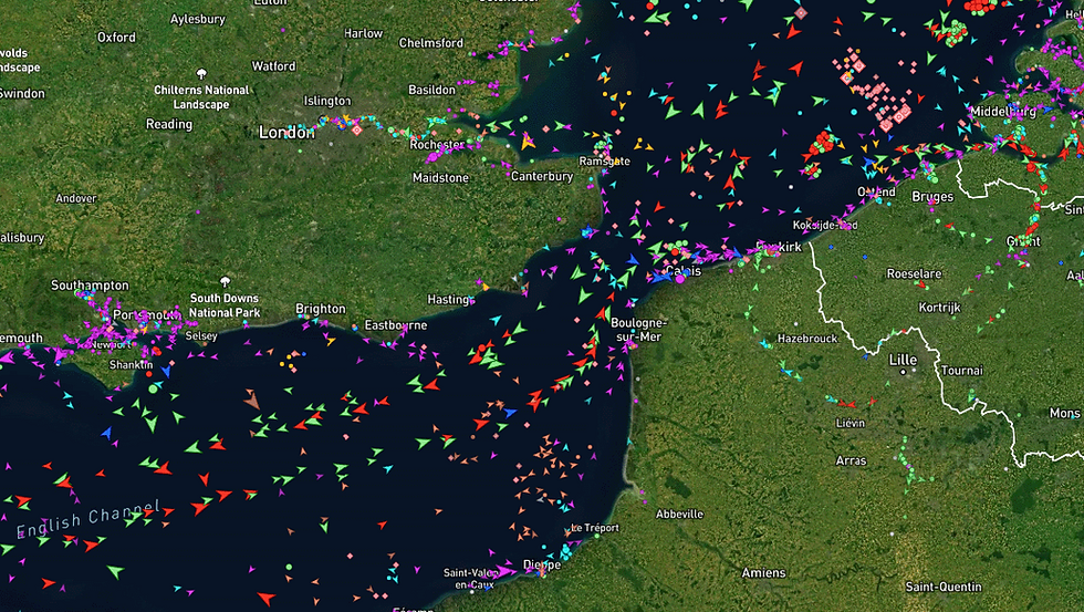
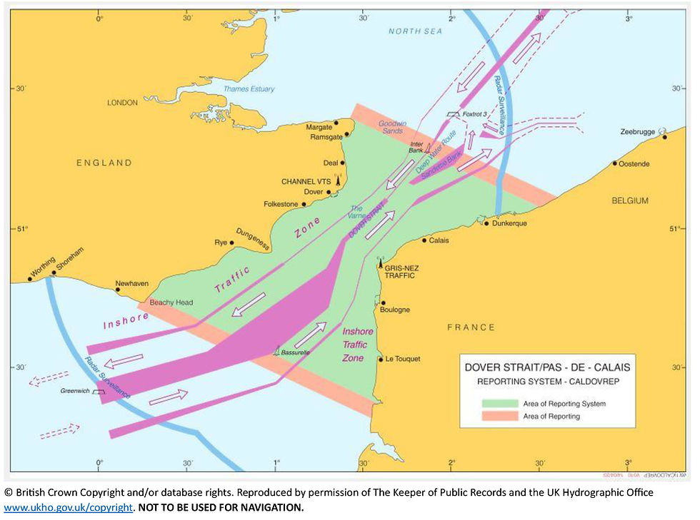
Using the displays, Tony was able to identify every vessel passing through the channel and see detailed information about that vessel. With his vast amount of experience he was also able to identify unusual movements which he did a couple of times when showing us the system. He then explained the complex TSS or Traffic Separation Scheme to us.
Two traffic lanes run through the Strait of Dover, a bit like a dual carriageway for ships. Vessels travelling from East to West use the lane nearest to the English coastline and are under the control of VTS. Those travelling from West to East use the lane nearest to France and are under control of the French equivalent, CROSS Gris Nez.
The rules for navigating in or near a TSS are internationally agreed. Mariners must be aware of the traffic lanes, separation zones, and inshore traffic zones and it is the job of VTS to ensure that every vessel uses the lanes as they should. Failure to do so can result in letters of reprimand or even convictions.
The Strait of Dover has strong tides and sandbanks and weather conditions can change quickly. Visibility is often poor, and it can be difficult to navigate. Large vessels passing through the Strait can be difficult to manoeuvre often taking several miles to stop or turn. Some container vessels are frequently over 300 metres long, with drafts in excess of 12 metres and travelling at speeds in excess of 20 knots (23 mph). They have to commit to a course of action long before a swimmer or small craft may be detected on radar or visually.
Much of the cross-channel traffic includes high-speed ferries carrying large numbers of passengers and vehicles. Many ships carry dangerous cargoes which, if released accidentally could have disastrous effects on the environment, marine life and the coastlines of England, France, and the North Sea countries. Some vessels experience minor engine problems which can be sorted out quickly without Channel VTS getting involved, other situations are more serious and can take longer to resolve and may require the assistance of HM Coastguard, hence the close working relationship between the two authorities.
The areas marked on the chart above showing Inshore Traffic Zones are primarily used by vessels that are less than 20 metres in length, sailing or fishing vessels. These zones are also used for larger vessels in emergency situations, a bit like Hard-shoulders on motorways.
The two salmon coloured lines marked across the Channel define the line of reporting for vessels over 300 tonnes. When approaching and crossing these lines the vessels must report to either the French authorities or the English VTS – called a CALDOVREP. The report is a radio transmission detailing important information about the vessel, its speed, course and cargo. It is an offence not to file this report before entering the area. Once in the area, VTS and the vessel contact each other roughly every 15 minutes until they exit.
The purple areas running through the channel are areas of shallow water and sandbanks which make up the separation zone. These areas are restricted to certain vessels and activities including fishing and windfarms and serve to separate the two traffic lanes.
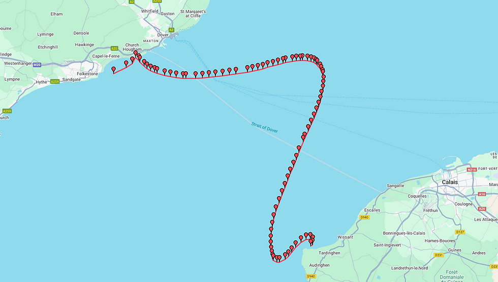
Finally, Tony explained the rights of way as there are several Channel ferries crossing these busy lanes every hour day and night. It is the VTS teams job to ensure that ships are not on a collision course and it takes a skilled eye to plot the courses of multiple vessels. In essence their role is very similar to an Air Traffic Controller. Tony showed us one hazardous activity which presents a further challenge to shipping in these busy waters – cross channel swimmers. These are particularly challenging because they do not take a direct line across the Strait as a ship would. Instead, the tides and currents wash them north and south in a large arc as they swim the 20 or so miles to get to France. At the time of our visit there were approximately 7 vessels accompanying swimmers near the French coast.
In the VTS operations room, Tony introduced us to the team who have a constant live video link to the VTS team in Falmouth, it was like they were sitting in the room we were in and we could have a normal conversation with them.
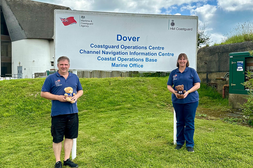
After an incredibly fascinating tour, Tony took us outside and up the small hill to the Helipad where we had the most amazing view of the channel and the coastline. He very kindly took a photo of us and the centres sign before we said our goodbyes.


What an incredible experience and an absolute privilege to see behind the scenes of these agencies that help to keep shipping safe in the English Channel and coordinate rescues when people get into difficulty in the sea and on the shoreline.
Find out more about these agencies from the following links:


Comments